Thoughts on Portland’s Greenways report

Earlier this week the City of Portland put out a report on their neighbourhood greenways (historically called neighbourhood bikeways), which like Vancouver, formed the backbone of their biking network for several decades. There has been a lot of talk in Portland about the frankly terrible conditions that some of the greenways have descended into: lots of fast moving cars making biking downright uncomfortable and dangerous.
greenways poster map FINAL v2013
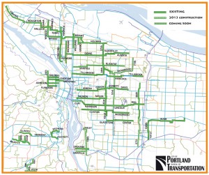
Map of Portland Greenways – 2013

What makes the report interesting is that is the first that truly digs into the existing conditions and sets out clear targets for greenways, which have traditionally get a sign and not much else (as anybody riding on Vancouver St or Haultain in the City of Victoria can tell you). Looking at the report, I had a few thoughts about what it gets right and what could be improved.

What the report gets right

It exists

No other city that I know of has done a comprehensive look at their greenways/bikeways in this way, especially looking at motor vehicle volumes and speeds. Kudos to PBOT for taking this one.

It highlighted the role a greenway plays beyond biking

Bikeways were rebranded greenway to recognize that their role goes far beyond making biking more comfortable for the All-ages and Abilities crowd. Portland has been great about creating people-spaces along these greenways.

The focus was on reducing motor vehicle speed and volumes

In the grand scheme of things, nothing else matters. Bioswales, signage, wayfinding and pretty pavement don’t matter unless the number of cars and how fast they are going drops

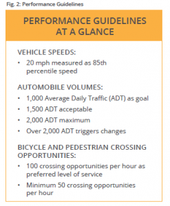
PerformanceGuidelines

It sets targets

Neighbourhood bikeways lack good design criteria. Unlike say, a bike lane, there isn’t a set of universally accepted standards. There were informal numbers, such as 1,000 cars per day, or 30 km/h, but until now nobody has truly coded that into their policy documents in such a strong way. This report lays it out in bold, clear terms, allowing staff, councils and advocates to start a conversation at the same place.


What needs some work

Cartography

Sorry PBOT, but “No Data” and “Meets the Standard” are completely different. No Data means just that; conflating it with areas that have been tested and meet the standard tells us nothing. PBOT should reissue these maps clearly separating out No Data from Meets Standard.
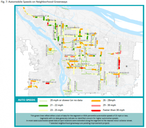
No data ≠ meets standard

Acceptable vs maximum

The report rather sets out 1,500 cars/day as the acceptable, but 2,000 as the maximum. But bizarrely, from 1,500 to 2,000 cars per day is unacceptable, yet action is only taken until the number passes 2,000. Given that traffic volumes can vary huge amounts per day (30%+), the threshold for action should be 1,500, not 2,000.

(Yes, I am aware of the Oregon-specific legislative requirement regarding speed limits and cars per day)

Final Thoughts

All in all, an excellent report that other cities should emulate. Neighbourhood greenways/bikeways are such an important part of the city fabric, both for bikes and more, that

If you want to read more, I suggest any of the posts on the topic by the always excellent BikePortland:

New activist group off to fast start: First protest ride is tonight

Council vote today would allow more diverters on neighborhood greenways

Neighborhood greenways breeze through council with unanimous support
CRD gets federal gas tax money for PCMP implementation

Finally announced, the CRD recently received $780,950 from the Government of Canada’s Gas Tax Fund transfer to implement various part of the Capital Regional District’s (CRD) recently completed Pedestrian and Cycling Master Plan (PCMP). The full announcement can be found on the Canada News Centre or from the CRD’s 2013 Media Releases.

Excitingly, this means a whole series of pilot projects for all the “E”‘s from the PCMP, including Engineering aka infrastructure such as:

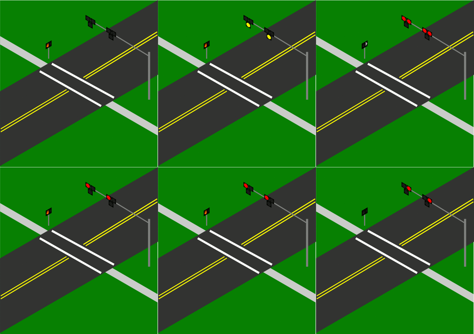
Bike activated warning signals
Such as HAWK beacons

HAWK signal
HAWK signal (Image credit: Wikipedia)

Advisory bike lanes (Minneapolis has a few)

Advisory Bike Lane in Minneapolis
Advisory Bike Lane in Minneapolis (Photo credit: City of Minneapolis)

Traffic calming for bike boulevards

Traffic barrier at Haultain and Shelbourne
Traffic barrier at Haultain and Shelbourne (Personal photo)


Other engineering projects include solar-powered signage, automated count stations, and secure lock-up systems that support dual-mode trips such as cycling and transit. The “soft” E’s including Education and Encouragement, Enforcement, Evaluation aren’t left behind either. Should be fun times!

(Full Disclosure: I work for CRD Regional & Strategic Planning and am the Bicycle Count Coordinator for the CRD)

Oak Bay’s Active Transportation Advisory Committee is blogging

Kind of late to this party, but they don’t seem to have much Google-juice (they are page 7 on my search for “Oak Bay Active Transportation”), so here it is: Oak Bay Active Transportation at Blogspot.

Their recent Complete Streets policy is a great start, here’s to many more successes for them.

Oak Bay releases Active Transportation Plan

Oak Bay Council last night approved the Active Transportation Plan, a first for the municipality. Developed by Boulevard, based here in Greater Victoria, the plan covers walking and cycling, as well as touching on public transit.

I will have more to say about in the next day or so, but I wanted to post it here so other’s could read it. Please ignore the comments on the side of the page, they are my notes.

[download id=”10″ format=”1″] And sorry about the size, I wanted to upload at a high resolution so that the maps came through.

Oak Bay posts Active Transportation Plan RFP

Want to help change the face of transportation in Oak Bay? The municipality is looking for a team to put together an active transportation plan. What should this plan address?

The main goal of the Active Transportation Plan is to enhance choices and opportunities and improve the usage of human-powered forms of travel and recreation within Oak Bay. It should also promote physical activity and healthy lifestyles for all ages and support green initiatives within the community.

What do you need to enter? Three hard copies of proposal marked “Active Transportation Plan Proposal” addressed to Loranne Hilton, Municipal Clerk, District of Oak Bay, 2167 Oak Bay Avenue, Victoria, B.C. V8R 1G2 on or before Friday, February 18, 2011 at 4:00 p.m. local time.

The full RFP can be download here: [download id=”6″ format=”1″] (PDF).

(Full disclosure: As a member of the Community Initiatives Committee that will be overseeing this plan, you cannot contact me with any details of any bid. To do so would be a bad thing and illegal.)

Black Press talks cycling

With a great deal afoot with cycling in the Greater Victoria area — the CRD Pedestrian and Cycling Master Plan, recent works in Oak Bay and the future bicycle plan, etc.

Vivian Moreau of the Oak Bay News came to the recent Active Transportation forum, focusing her article on the Spokesmen, a group of Oak Bay cyclists who ride together each Saturday morning, and their spokesperson (sorry) Stuart Culbertson noted what many cyclists in Oak Bay know: home is where the bike lanes stop (although that will be slightly less true in the new year).

In the good news department is the recent referendum victory for a new Johnson St. Bridge, which promises to elminate a major bottleneck at the end of Galloping Goose & Lochside Trails. Hopefully the CRD will get gas tax money to save the rail link, as well. (The Times Colonist covered Victoria Mayor Fortin talking about possible funding sources today)

The Victoria News actually does a pretty decent piece of work with their article on the bridge and cycling in Victoria, even mentioning the problem with vehicular cyclists’ crazy belief in stopping all bike lanes and other similar works.This group often muddies the waters, writing letters to councils who don’t know which group of cyclists to believe.

And for the last little bit of amusement, question 7 on this faux questionnaire:
Q7. When people discover that you work for the City of Vancouver they complain to you first about:

a) Bike lanes.

b) Backyard chicken coops and bike lanes.

c) The former Olympic Village and bike lanes.

d) Property-tax rates and bike lanes.

Ah, municipal politics, isn’t it fun?

Please shovel your sidewalk

Just a reminder to think of us poor pedestrians and keep the sidewalks clear. Oak Bay bylaws require the adjacent property owner to shovel the sidewalk and keep it clear. Quoting 43.6 of the Streets & Traffic bylaw (PDF):

being the occupier, and in case there is no occupier, being the owner or lessee, of land and premises abutting any sidewalk shall permit any accumulation of snow, ice, dirt, litter or rubbish to be or remain upon such sidewalk;

Have fun in the snow.

A pictorial journey along the E & N Rail Trail

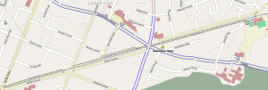
The E & N Rail Trail, boldly promised to be finished by “the 2010 Olympics” just a few years ago by the CRD (PDF), is now finally taking shape in Langford. I thought I would bike out there and see how it measured up.

For starters, this little section of the trail is tiny. Much like the Bowker Creek Greenway in Browning Park I talked about, network effects mean that both trails will get few users until such time as more of them are completed.

E & N Rail Trail Map. Map data: OpenStreetMap/OpenCycleMap

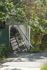
Starting for the westernmost side on Atkins Road, the trail starts with a very old pedestrian bridge over the trail, which was created for the students of Savory Elementary School. On the other side of the bridge you are dumped into the school yard about 50m from the actual start to the trail.

The old pedestrian bridge]
The old pedestrian bridge
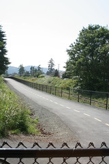
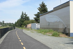
Looking west at the start of the trail
Mural, with parking to the right

The trail itself is straight and fairly flat, although immediately the potential for conflicts with the adjacent parking lots became apparent. Why the CRD/City of Langford didn’t choose to at least bollard off this I don’t know. As it is, it is far too easy to drive onto not only this section of trail but also one other section west of Phipps Road.

Mural, with parking to the right
Murals, with parking to the right

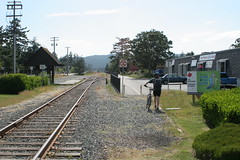
After crossing Veteran’s Memorial Parkway at Goldstream you wonder where the trail went. I really hope this is a temporary thing (there were construction signs everywhere along the trail stating it wasn’t open yet) because you can see just how bad it is.

East of Veteran's Memorial Parkway, the connection to the trail is sadly lacking.

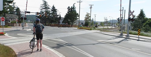
At the other end of this section, the section between the sidewalk and the trail is likewise unfinished. But that isn’t the worse part about the Peatt Road crossing. For some unknown reason, rather than just crossing in parallel with the rail line, you are forced to travel south to the intersection, cross Peatt there, then along the sidewalk, cross back over rail line (as of yet unfinished) and to the trail. Utterly ridiculous.

The Peatt Road crossing

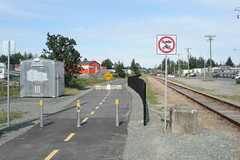
The other end of the trail (and current westernmost end) just dumps you out onto the sidewalk. No indication where you could go next for another trail, etc. I realize that the trail’s costs ballooned, but still. A simple sign directing you back to the Galloping Goose would have been nice. At least it has a connection to the road.

Westernmost end of the trail

And thus we finish this section of the E&N Rail Trail. It is a great start but there are a few head-scratching decisions here and there. Hopefully these can be fixed but it is better to get it right the first time. Let’s hope the CRD and their member municipalities open up the design phase a bit earlier so that these mistakes can be caught and corrected before they are concrete (literally). To see larger versions of these pictures (and a few others) see my flickr set.

Bowker Creek Greenway arrives … in Saanich

Trail circle at Browning Park

The Bowker Creek Greenway is starting to appear in Browning Park in Saanich. As I mentioned last fall, it is funded by provincial money via LocalMotion and federal stimulus dollars. When I was there yesterday, the asphalt had been poured but the construction fencing was still up. This wasn’t stopping people, as the new, very black asphalt was covered in footprints, of the human and canine variety.

Browning Park with approx. trail location

Later that evening I spoke with a Saanich Parks rep (at an event on a new 20 year plan for the Cadboro Bay Gyro Park) about the greenway and he stated the last work left to do was some curb cuts and some concrete. He didn’t give me a timeline but the amount of work is pretty minimal so I don’t expect it to be too long now.

One of the sad parts about this project is that the trail likely won’t see a great deal of us because it is isolated in amongst the very car-centric Shelbourne Corridor area (although the whole corridor is being rethought, as I reported a few months back). The next pieces should be easily to get built, because now they are extensions onto an existing trail, not the creation of a new trail whole cloth.